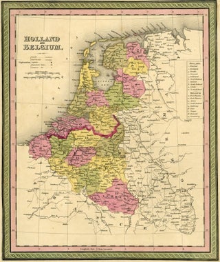
Map of Holland and Belgium, Cowperthwait ca. 1850
Philadelphia: Cowperthwait, 1850. From Mitchell's A New Universal Atlas, ca. 1850. Attractive, with color. Image measure 12 1/2" x 10"., slight foxing in the margins, otherwise clean. Size: Octavo (8vo). Quantity Available: 1. Shipped Weight: Under 1 kilo. Category: Prints, maps, broadsides; Inventory No: 044566. More